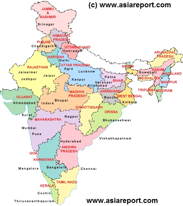
This Schematic Geographic relief Map gives a full overview of the territories of the Republic of India (--), the worlds largest Democracy, 2nd most populous Nation and by size the worlds 7th largest Nation, which today is made up out of the 29 seperate states and 7 "Union Territories".
The 29 States of India are:
Andra Pradesh, Aranuchal Pradesh, Assam, Bihar, Chhattisgarh, Goa, Gujarat, Haryana, Himachal Pradesh, Jammu and Kashmir, Jharkand, Karnataka, Kerala, Madhya Pradesh, Maharashtra, Manipur, Meghalaya, Mizoram, Nagaland, Odisha, Punjab, Rajasthan, Sikkim, Tamil Nadu, Telangana, Tripura, Uttar Pradesh, Uttarakhand, West Bengal.
Notably, on June 2, 2014 Telangana became the 29th State of India splitting away from Andra Pradesh. The new State Capital of Telangana will be Hyderabad City.
The 7 Union Territories of India are:
Andaman and Nicobar Islands, Chandigarh, Dadra and Nagar Haveli, Daman and Diu, Delhi, Lakshadweep, Puducherry.
Notably, Delhi and New Delhi enjoy a special status among the Union Territories as National Capital Territory.
Browse the Map and link through for more information by location where available >>>
