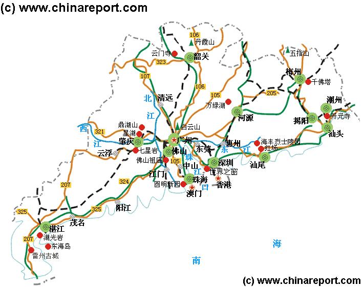
The below Schematic Map gives a clear overview of Guangdong Province of South China (PRC). No information is included on Bordering Provinces.
Browse around the Map to view the Main Population Centres of the Province as well as the Main Highways and Roads, Rail- and Air- Connections within Guangdong Province today.
Main Highways are highlighted in Dark Green Color, secondary Provincial Roads are designated in Light Brown Color.
Railroad connections in Guangdong Province are marked as Back Dotted Lines.
Click the Buttons of Main Cities and odd landmarks to follow the Link to Further Information on this Location !!
