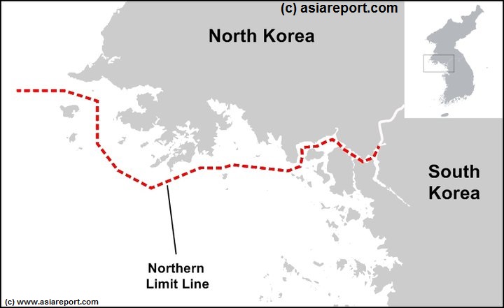
This very Schematic and dated Map shows the western half of the Northern Limitation Line (N.L.L.) maritime border between North- and South Korea.
Further included are ..
Please Browse the Map to identify all (City) Prefectures within and Follow the Links to find additional Information on each Location.
This page was last updated on: May 19, 2015
Schematic Map of N.L.L. West - Maritime Border North & South Korea.
Follow the Buttons & Links to additional Information on Nations, Regions, Tribes, Provinces & Cities
This page was last updated on: May 19, 2015
My Great Web page
Schematic showing the location of the western NLL and location on the Map of the Korean Peninsula.

