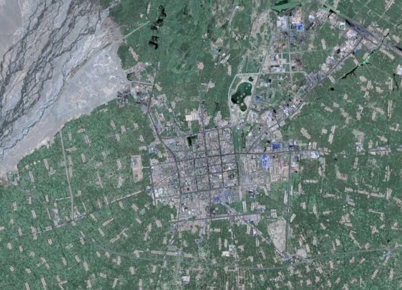
Looking clockwise around the main features of this Satellite Image based map are: In the East and North-East, the flow trajectory of the Hei He or Black River. The Hei River is the main river in this section of the mountainous Hexi Corridor and is the main source of water and the green abundance of Zhangye. In the North-East lies the Zhangye Railway Station, one of many along the Lanzhou-Urumqi Railway.
Zhangye is surrounded by irrigated lands, which are mostly used for agriculture. Provincial Road G.312 leads from East to West through the Image. Eastward it travels to Shandan. The main highway and thoroughfare of the City and Region is the Shanlin Expressway, designated as National Road 312. The Shanlin Expressway, or Lanzhou-Urumqi Highway is a well-kept modern highway which leads past the City of Zhangye someway's South of it. Note: this Highway is not to be confused with G312 Provincial Road. Which comes into the City from Shandan in the East, but leaves the City through its North-west corner.
Find the modest City Urban Area in the center of the City and view the general lay-out, square shaped and including roads which lead in a North-South or West to East direction.
For easy navigation, the Drum Tower stands at the Center of the Old City. From there, most City landmarks & monuments are within walking distance. Only the Double Pagoda and the Gao Miao Temple require a Taxi or Bus Drive.
Hotels are centered around the Drum Tower and main East-West Boulevard. More can be found along the Road between the Old Town center and the Main Train Station.
For the convenience of Tourists and locals alike, there are at least 4 supermarkets in the City and a Shopping Mall.

