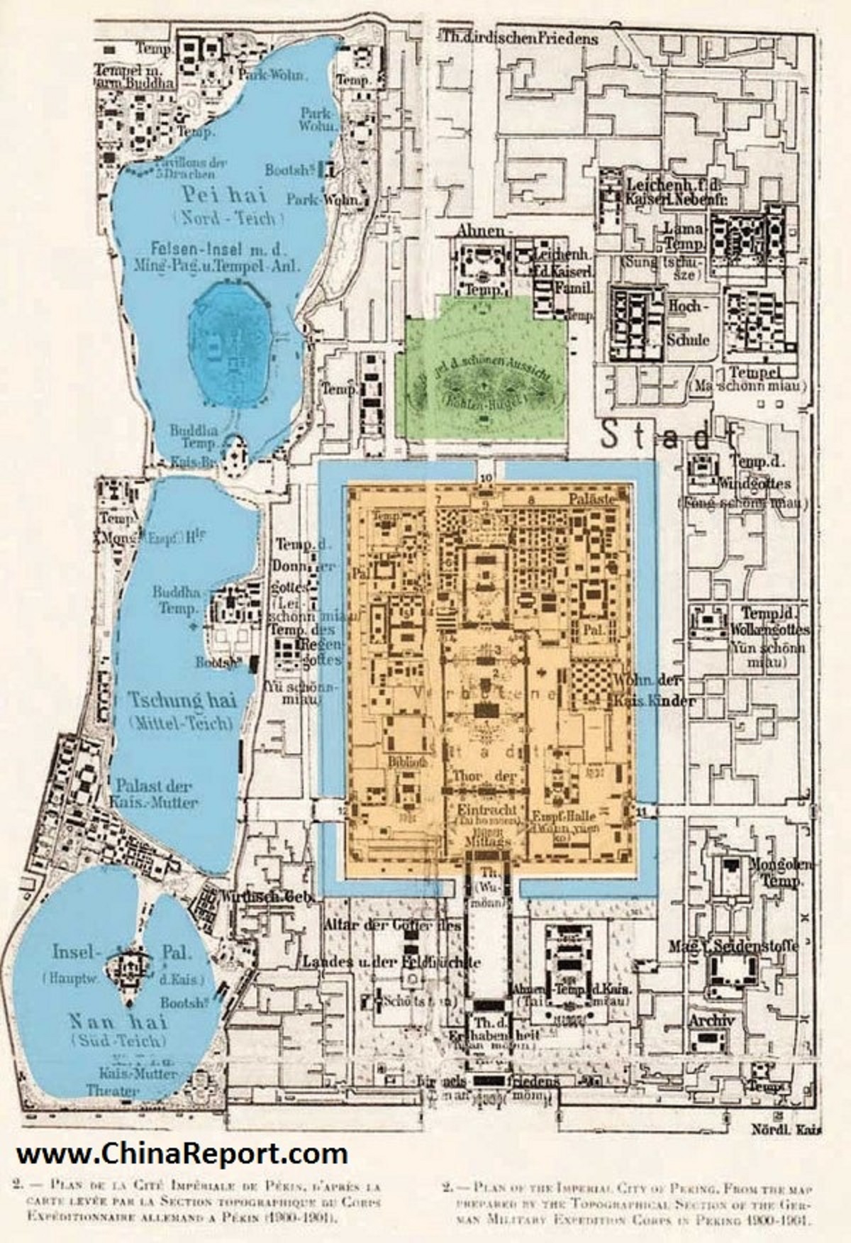
This Historic Map of the year 1900 AD provides a clear overview of the so called Imperial City of Beijing, which is the area of the extended Imperial Palace with at its center the core Palace of the Emperor, the so called Forbidden City.
The Imperial City was a restricted and protected zone which covered large portions of today's Xicheng and Dongcheng Districts and included as is shown on the map; North Lake (Park), Jingshan (Coal Hill) Park, the current day Palace Museum (Forbidden City) as well as the South and Middle Lake complex (Zhongnanhai for short). Today the former Imperial City has been dissolved and fragmented but it is still recognizable by its Red chalked surrounding walls. All of its Gates have disappeared since. Its various parts are now mostly open to visitors as public parks, however not so with the entire Zhongnanhai Complex which ranks among the most secure zones within the city of Beijing.
Created by the engineering corps of the invading German Forces during the so called Boxer War (1900 - 1904 AD) this general map meticulously includes the location, size and lay out of most structures, palaces, towers and pavilions, streets, walls, moats and gates within especially select and elite Imperial City District of the Time.
Browse the Map and Click through to additional Maps highlighting each partial area within the former Imperial City Area. For backgrounds and photo's, click red buttons and go through.
